Events Calendar
Current Weather
Lake Travers Access Point (#23) 
Location
Continue on the main road past the Sand Lake Gate for 54.4 kilometres, passing through the Algonquin Radio Observatory area, before reaching the access point at the mouth of the Petawawa River at the southwest tip of Lake Travers. Latitude and longitude of Access Point: 45.960188°, -78.062545°
Facilities
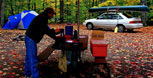
- Parking
Backcountry Permits
Make a reservation for your backcountry camping permit up to 5 months in advance. Permits are only available online or via telephone.
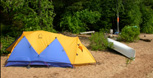
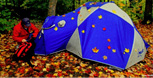
Equipment Rental
Do you need to rent a canoe, tent, or other camping equipment? Find a business that can supply some or all of the required equipment for your backcountry trip.
Water Levels
Check for special advisories prior to your departure at Algonquin Park Advisories.
Related Information
 Sand Lake Gate
- Whitewater Canoeing - Petawawa River
- Petawawa River Whitewater Guide
 Crooked Chute Ranger Cabin
- McManus Lake Access Point
 Achray Campground
 Eastern Pines Backpacking Trail
- Backcountry Canoeing
- Canoe Routes Map - Explore Online
Reserve your developed or backcountry campsite for your next visit.


Share your passion for Algonquin Park by becoming a member or donor.

Special regulations for Algonquin's special fishery.