Events Calendar
Current Weather
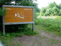
Eastern Pines Backpacking Trail 
 Description
Eastern Pines is an overnight backpacking trail with loops of 6 - 15 kilometres in length. The trail can be accessed from Grand Lake - Achray Access Point.
Length
- 6 to 15 km
Location
- Eastern Pines Backpacking Trail is located at Grand Lake - Achray Access Point.
- Latitude/Longitude: 45.867298°, -77.755674°
Operating Dates
- Open from the late April/early May to late-October.
- See possible closures at Algonquin Park Advisories.
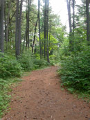
Difficulty Rating & Rationale
- Difficult. Steep climbs, side slopes and sharp turns.
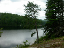
Features & Amenities
- Parking
- Bathrooms
- Scenic lookouts
- High Falls on the Barron River
- Glacial boulder garden
- Lakes and rivers
Trail Map
The Backpacking Trails Map of Algonquin Provincial Park is the essential trip planning map-brochure that outlines detailed routes, campsite locations, required equipment, how to make campsite reservations, and important safety information.
Backcountry Permits
Make a reservation for your backcountry camping permit up to 5 months in advance. Permits are only available online or via telephone.
Fees
A valid camping permit is required for trail use.
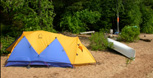
Equipment Rental
Do you need to rent a canoe, tent, or other camping equipment? Find a business that can supply some or all of the required equipment for your backcountry trip.
Nearby Attractions
- Achray Campground
- Yurt
- Grand Lake - Achray Access Point
- Berm Lake Trail
- Jack Pine Trail
- Barron Canyon Trail
- Sand Lake Gate
Related Information
- Western Uplands Backpacking Trail
- Highland Backpacking Trail
- Backpacking Trails of Algonquin Provincial Park (map)
- Interpretive Walking Trails


Reserve your developed or backcountry campsite for your next visit.


Share your passion for Algonquin Park by becoming a member or donor.

Special regulations for Algonquin's special fishery.