Events Calendar
Current Weather
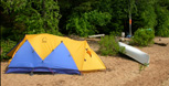
Backpacking in Algonquin Park 

Throw on your backpack and head out for a few days and nights of camping in Algonquin Park's backcountry. Backpacking trails allow you to explore loop routes ranging from 6 to 88 kilometres in length.
The Backpacking Trails Map of Algonquin Provincial Park is the essential trip planning map-brochure that outlines detailed routes, campsite locations, required equipment, how to make campsite reservations, and important safety information.
 Algonquin's Backpacking Trails
More Backpacking Information
Related Information
Reserve your developed or backcountry campsite for your next visit.


Share your passion for Algonquin Park by becoming a member or donor.

Special regulations for Algonquin's special fishery.